


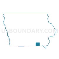
CLEVELAND TWP PART Voting District, Davis County, Iowa
About
Outline

Summary
| Unique Area Identifier | 581928 |
| Name | CLEVELAND TWP PART Voting District |
| County | Davis County |
| State | Iowa |
| Area (square miles) | 40.24 |
| Land Area (square miles) | 39.94 |
| Water Area (square miles) | 0.30 |
| % of Land Area | 99.25 |
| % of Water Area | 0.75 |
| Latitude of the Internal Point | 40.74616950 |
| Longtitude of the Internal Point | -92.40444660 |
Maps


Graphs
Select a template below for downloading or customizing gragh for CLEVELAND TWP PART Voting District, Davis County, Iowa


Neighbors
Neighoring Voting District (by Name) Neighboring Voting District on the Map
- BLOOMFIELD W/CLEVELAND TWP PART Voting District, Davis County, IA
- DRAKESVILLE TWP Voting District, Davis County, IA
- FOX RIVER TWP Voting District, Davis County, IA
- GROVE TWP Voting District, Davis County, IA
- LICK CREEK TWP Voting District, Davis County, IA
- PERRY TWP Voting District, Davis County, IA
- PRAIRIE TWP Voting District, Davis County, IA
- SOAP CREEK TWP Voting District, Davis County, IA
- UNION TWP Voting District, Davis County, IA
- WEST GROVE TWP Voting District, Davis County, IA
- WYACONDAH TWP Voting District, Davis County, IA
Top 10 Neighboring County Subdivision (by Population) Neighboring County Subdivision on the Map
- Bloomfield city, Davis County, IA (2,640)
- Lick Creek township, Davis County, IA (865)
- Cleveland township, Davis County, IA (761)
- Soap Creek township, Davis County, IA (643)
- West Grove township, Davis County, IA (571)
- Drakesville township, Davis County, IA (481)
- Prairie township, Davis County, IA (402)
- Fox River township, Davis County, IA (353)
- Wyacondah township, Davis County, IA (347)
- Perry township, Davis County, IA (311)